


Points of Interest:
- See the largest limestone glades north of the Missouri River.
- Enjoy rich wildflower displays all growing season.
- Watch for a variety of glade and woodland birds.
Natural History:
This natural area features the largest high-quality limestone glade complex north of the Missouri River. The area lies at the northern edge of the Ozark Highlands ecoregion just south of the Central Dissected Till Plains ecoregion of Missouri. The glades occur mid-slope on west and south facing aspects and are surrounded by acidic, dry woodlands of post and blackjack oak on upper slopes and alkaline dry to dry-mesic woodlands of chinkapin oak and blue ash on lower slopes. The glades and open woodlands support abundant native grasses and legumes and are excellent habitat for wild turkeys. The Conservation Department has utilized thinning and prescribed fire to restore the glades and woodlands on this site.
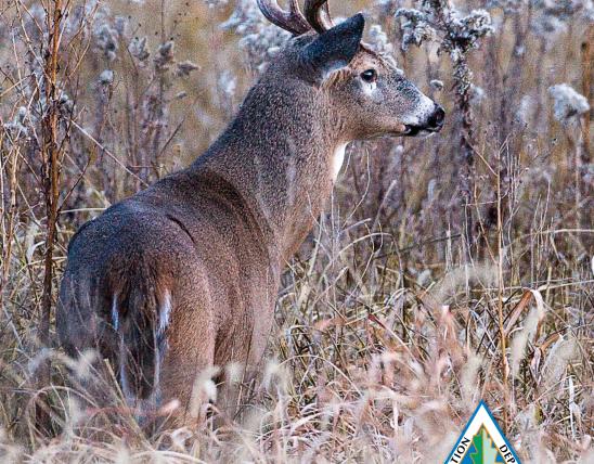
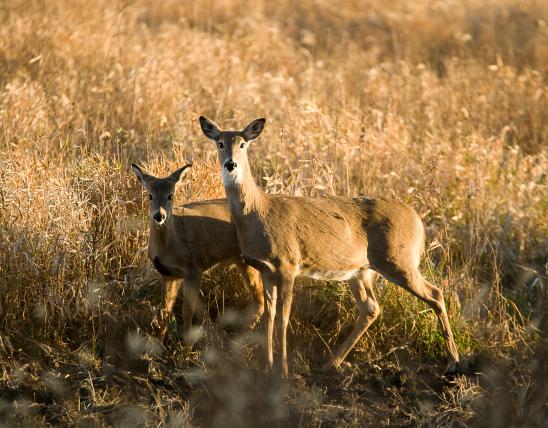
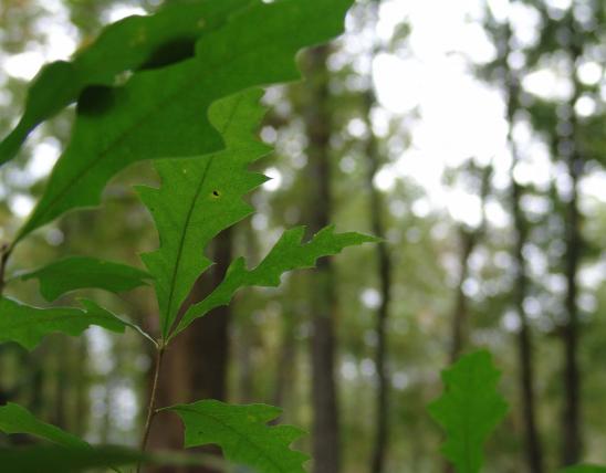
363 native plant species have been documented from the site including a number of characteristic limestone glade plants such as gum bumelia, scurfy pea, prairie dock, silky aster, glade milkweed, shaggy evolvulus, and cylindrical blazing star. Look for lichen grasshoppers, prairie racerunners, and flat-headed snakes on top of glade rocks. Listen and look for the summer tanager, blue-gray gnatcatcher, and eastern wood-peewee in the woodlands surrounding the glades. The glades often have prairie warbler, yellow-breasted chat, and white-eyed vireo frequenting them. Note that some of the post and chinkapin oaks around these glades are 200 years old.
An interesting facet of Danville Glades is the proximity of small sandstone glades to the larger areas of limestone glades. The acidic sandstone glades support a different suite of plant species than the alkaline limestone glades including hairy-lip fern and common rushfoil. The sandstone glades are home to an abundance of mosses and lichens in contrast to the limestone glades.
The natural area is comprised of two units, an east and a west, both within Danville Conservation Area. The east unit contains a 3 mile loop hiking trail, Danville Glades Trail, which follows a field road for most of its length. To reach the east unit, take Interstate 70 to the Highway 19 exit (Exit 175). Go south on Highway 19 just 100 yards and then go right (west) on the interstate outer access road. Proceed west on the outer access road for 2.5 miles to Highway RB. Head left (south) on Highway RB for 2.6 miles. At this point the pavement ends. Turn left (east) on the gravel road into Danville Conservation Area. Follow the gravel road for 1.4 miles to the parking lot. At the parking lot, head north on the Danville Glades Trail which follows an old field road. A map and compass is recommended to explore the area. To reach the west unit, follow directions above to the end of Highway RB. Turn right (west) and proceed for nearly a mile on gravel Turkey Ridge Road to a parking lot on the left (south) side of the gravel road. Park here and follow the gated field road that starts immediately on the other side of Turkey Ridge Road (north side of road) and head north following the field road for a hike of nearly 1.5 miles. A map and compass is recommended to explore the area. Hunting and fishing are permitted.

United States